StreetSweeper® Pro Support
Find solutions
Features & Settings
This document lists the parameters available for automation in StreetSweeper Pro. It includes notes on changes for legacy users to facilitate conversion to the new product.
This feature will automatically save Projects after certain functions, such as correction, have been completed.
Certain Special Handling presorts require the creation of a mailing plan for uploading to the Canada Post electronic shipping tools.
Using this option, you can see if your CMA module has an active license. If you do not have an active license, please contact your Pitney Bowes sales representative.
This service requires an additional annual subscription. Please contact your Pitney Bowes sales representative to add this license to StreetSweeper Pro.
Setting up data paths allows you to specify the default directories for input and output files, the usual work directory, and the directories that contain Canada Post and table file databases.
You can exit the application or log out an individual user.
In StreetSweeper Pro, you can customize and set your default presort settings.
Using this option, you can see how many credits (transactions) are remaining in your account. Each record process requires one credit.
You can switch between languages in StreetSweeper Pro.
New users will need to create an account before logging in. Existing users will use their existing account email and password.
If you have a regular presort project to complete, you can save the parameters and reuse them.
After processing your Project through address correction and validation, the Address Accuracy Report will automatically be created as a PDF file.
StreetSweeper Pro has an integrated lookup that will allow you to find an address using a drill-down functionality.
StreetSweeper Pro has an integrated lookup that will allow you to find or manually correct addresses using the Search By tool.
Merging fields allow you to create a single address line if your database has address components split into several fields. It will also allow you to merge complete address lines to meet the 2 line Canada Post maximum.
Using Geosmart, you can add latitude, longitude, and a time zone to each record in your database. Latitude and longitude are at the postal code level and represent the centroid (most central point) of the postal code.
If you have a list of target postal codes, Geosmart will calculate the closest of those postal codes for each record in your database. You can use this information to determine the closest target postal code for each record. As well, you can use this information to select records that fall within a prescribed distance from the closest target postal code.
If you have multiple target postal codes, Geosmart will calculate the closest of those postal codes for each record in your database. You can use this information to determine the closest target postal code for each record and to select records that fall within a prescribed distance from the closest target postal code.
After processing your Project through address correction and validation, the Address Accuracy Report will automatically be created as a PDF file.
Printing
After presorting your Project, you can select whether to print your container, bundle, and pallet/monotainer labels.
Printing
After presorting your Project, you can select whether to print your container, bundle, and pallet/monotainer labels.
Reporting, History & Accounting
If you did not intend to run CMA processing or you wish to return your Project to its pre-processed state, you can undo the CMA processing.
If you have chosen not to purge your results on processing, you will be able to view any matches.
A transaction report is created when CMA processing has been applied to your file.
After running CMA suppression on your Project, the report is always available through the central reports screen.
The company information entered into StreetSweeper Pro will be applied to reports. This information only needs to be entered once and then is stored as a default. The information can be updated at any time by returning to this screen.
After presorting your Project, the Delivery Office Volume Summary will automatically be created as a PDF file. This lists which the number of containers and mail pieces that will be distributed by Canada Post to each delivery office.
Geosmart will allow you to calculate the distance between each record in your database and a target postal code. You can use this information to select records that fall within a prescribed distance from that target postal code.
After presorting your Project, the FSA Volume Summary will automatically be created as a PDF file.
After adding geographic coordinates and/or distances to records in your Project, the report is always available through the central reports screen.
After presorting your Project, the Mailing Summary will automatically be created as a PDF file and displayed on screen.
After running NCOA processing on your Project, the NCOA transaction report is always available through the central reports screen.
If you did not intend to run NCOA processing or you wish to return your Project to its pre-processed state, you can undo the NCOA processing.
If you have chosen not to purge your results on processing, you will be able to view any matches.
You can save your Project with a user-selected or default filename.
After presorting your Project, the Container and Bundle Report will automatically be created as a PDF file. This lists the details of the bundles in each container.
After creating a Project, you can correct and validate address records.
Users can set standard options for correcting processing of Projects. These defaults can be overridden for a specific Project by changing the options prior to correction. These changes will not update the default options.
After opening your input file, the Field Mapping screen will appear.
If you need to reprocess correction for a Project, you must first undo any NCOA, CMA and/or presort processing that has been performed.
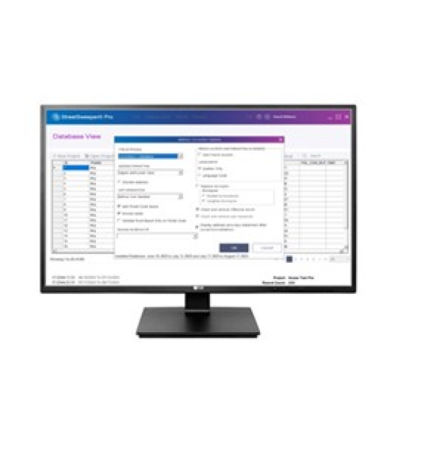
After creating your Project, you can view, filter, and search the database.
You can export your Project file at any point.
You can open previously saved Projects to continue working.
The presort process will prepare your mailing to be eligible for postal discounts.
After purging duplicate records from your Project, the report is always available through the central reports screen.
Processing your Project against Canada Post’s National Change of Address (NCOA) service will allow you to update recipients who have moved.
After suppressing records in your Project, the report is always available through the central reports screen.
New users will learn the process of creating a job with a fixed length.
New users will learn how to create a new job file in StreetsSweeper Pro.
For information on service offerings and level of support, download the
Pitney Bowes Technical Support Overview